This article is part of an ongoing series of shared content through our partnership with Architizer, a marketplace, resource, and community that connects architects to their peers, fans, and potential clients. You can find the original article here on the Architizer blog.
In recent years, Norwegian design studio Snøhetta has taken on some of the most prominent projects around the world, including a few notable challenges in the United States. Many of these projects completely reinvent the look, feel and, ultimately, accessibility of renowned historic sites.
Now, the team at Snøhetta is turning their attention to North America’s west coast on a site that was once lauded as the birthplace of the future, a region that is a bedrock of American history. The City of Oregon has commissioned a new riverwalk at the historic Willamette Falls along the Willamette River in downtown Oregon City. The 22-acre site, cut off from the public for over 150 years, will become a new destination for visitors to learn about the nation’s second-largest waterfall — by volume — and its industrial past. Snøhetta is proposing a pathway and new public space that reveals sections of the falls’ basalt topography and reconnects Oregon City to its waterfront.
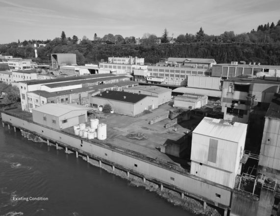
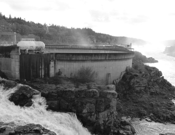
The site was formerly home to two paper mill factories and a hydroelectric power plant where the falls helped produce the world’s first long-distance electrical energy transmission. The construction of the Willamette Falls Locks in 1873 made it the only locks canal west of the Mississippi River, allowing for further expansion of the Pacific Northwest and causing it to quickly become a business hub and center for trade at the end of the Oregon Trail.
At 1,500 feet wide and four stories high, Willamette Falls could generate enough power to light up the entirety of nearby Portland. Throughout the 19th century, all eyes were on Oregon City and the massive amounts of production coming from the falls site; consider it the Silicon Valley of early-industrial American civilization. These were the early days of Portland General Electric.
Last week, Snøhetta released the final conceptual designs for the Willamette Falls Riverwalk in a comprehensive plan and series of watercolor-style renderings that depict the depth of changes being made to the significant site. In a multi-phase development, concrete from the Blue Heron Paper Mill, which closed in 2011, will restore the area’s natural habitats, while parts of the building and its other factory counterparts will be renovated and incorporated into the design.
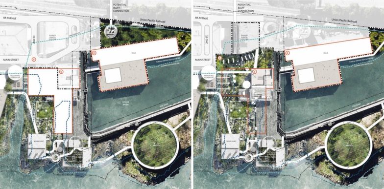
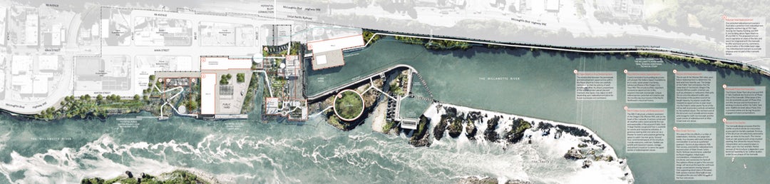
Snøhetta put forward two options that consider the reconstruction of Main Street as a flood-controlled access point. From there, each section of the large site is broken down into key uses: falls viewing, river access and activities, gathering and event spaces, habitat restoration, walkways and biking trails as well as historic reuse. This breakdown allows community residents to understand the scope of development and how a new master plan for the falls could enhance their city.
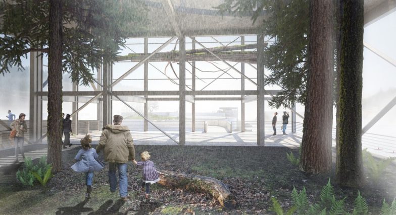
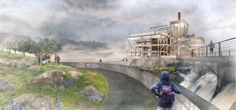
“The river-walk will serve as a portal to the Northwest’s collective history,” said Snøhetta, “reviving a former industrial site through its aggregated layers of natural, ecological, cultural and geological history.” The new design treats the whole site as a single landscape, with a network of promenades and lofted pathways that lace through the physical strata of the site, immersing visitors in a tactile experience that celebrates the changing water level, the feeling of the spray on your skin, the dramatic play of light and the roar and presence of the falls.
Per the design, the site is divided into four programmatic sections:
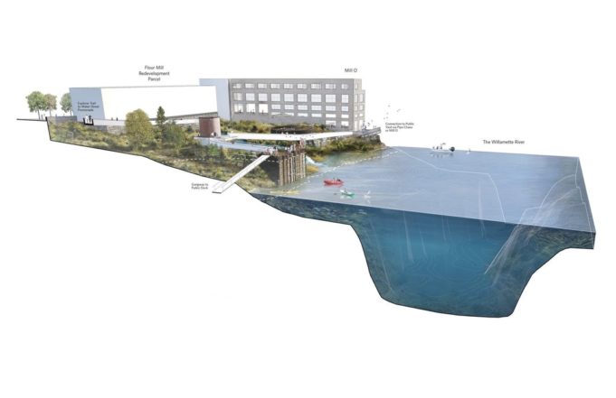
The North Riverfront and Flour Mill Foundation
Closest to downtown Oregon City, this section will peel away existing platforms and structures while carving out industrial fill in order to expose the basalt bedrock and foundations of a historic 1890s Flour Mill now dubbed Mill O. The Mill will be converted into a visitor’s center and feature a river theater, providing sheltered space for nature viewing and outdoor performances. A series of explorers’ trails will head north from Mill O.
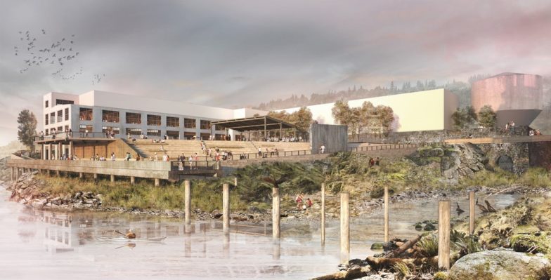
The Public Yard and Woolen Mill Alcove
On the south side of Mill O, a raised plaza called the Public Yard will host events, concerts, beer festivals and movie screenings and serve as a viewing area for water sporting events in the summer when the river’s flows are low. An informal pavilion is featured as the focal point of the Yard created from the historic Woolen Mill. Further urban fill and concrete structures will be removed to the south to restore and reveal the unique riparian basalt plant communities and off-channel alcove habitat.
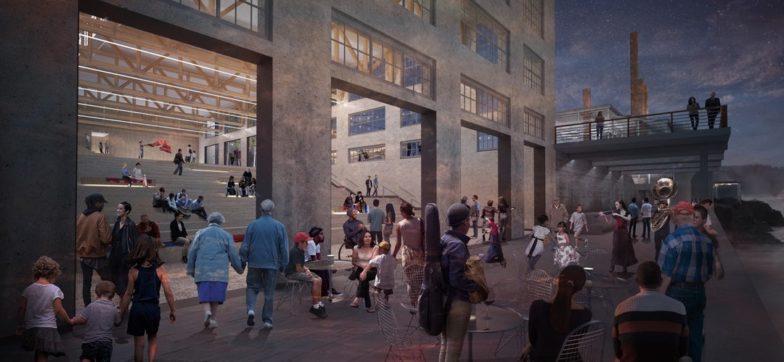
The Mill Reserve and Mill H Overlook
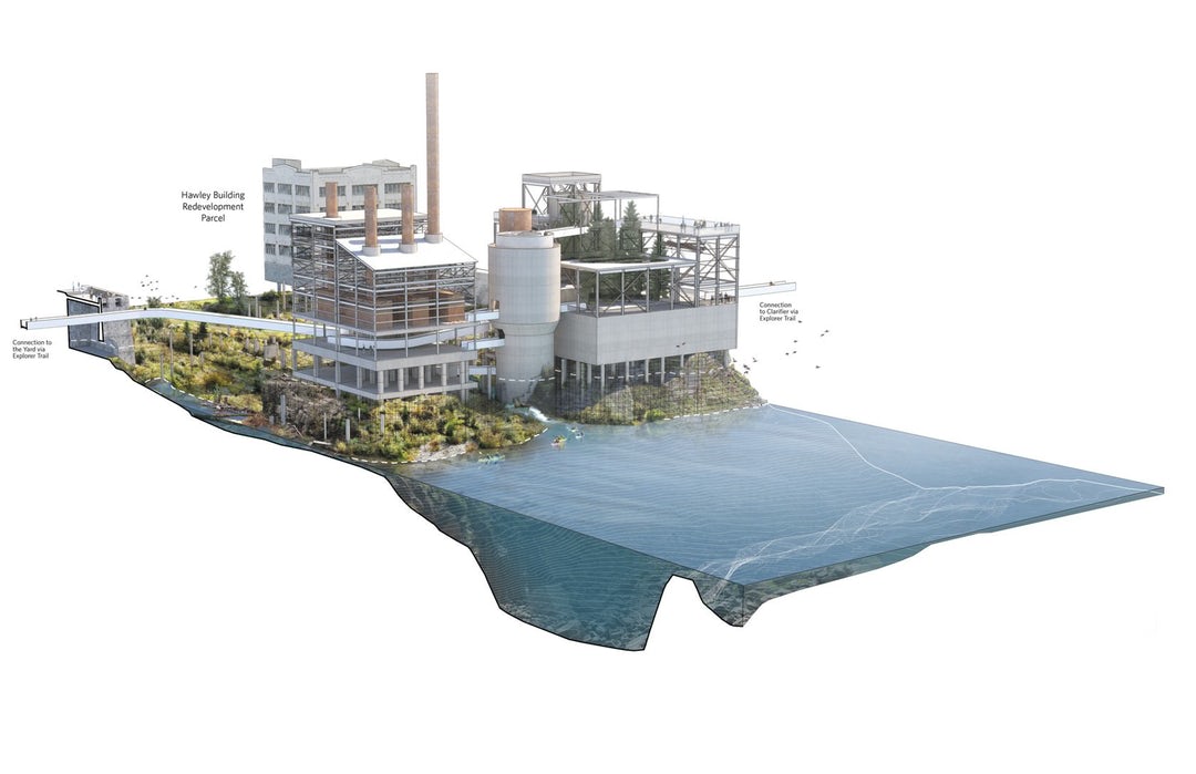 Here, the architects will remove exterior cladding from the existing Mill H structure, unveiling a reinforced steel and concrete framework for viewers to access the highest and lowest points of the riverwalk site. The open-air Mill H Overlook connects the currently dead-ended Main Street, once a major avenue in town, and offers panoramic views of the entire site and the PGE dam at its full height. The overlook is situated adjacent to the historic boiler plant complex, which the architects deem a “cathedral-like space.”
PGE Dam, the Clarifier and the Falls Overlook
Mill H will connect to the Clarifier, a water quality treatment facility formerly used by Blue Heron Paper. The site will feature a landscaped interior inspired by the region’s oak savanna habitat where visitors can picnic or rest with expansive views of the river and the still-existing West Linn Paper Mill. From there, the site will connect to the edge of the PGE dam via an elevated explorer trail headed toward Station A, the final overlook on the Willamette Falls Riverwalk. This will allow full public access to the falls when the dam promenade is closed for operations and maintenance.
The schemes shown above are the result of a two-year design process developed in collaboration with the City, its community members and local partners Mayer/Reed and DIALOG. The proposed redesign will restore a national treasure to Oregon City’s residents as well as create a safe natural habitat for local flora, fauna and wildlife to thrive once again.
Construction is expected to begin in June 2018.
Renderings and diagrams via Snøhetta