
Yes, we’ve heard it before, and, until conditions improve, we’re likely to hear it again: construction is among the least innovative of industries, a point driven home by Tom Scarengello, chairman and CEO of structural engineering firm Thornton Tomasetti, during his keynote address at BuiltWorlds Summit 2017, a gathering of industry thought leaders in Chicago that took place May 3-5.
Save for agriculture, construction ranked dead last in the innovation arena, Scarangello said, citing a study by Harvard University.
However, the technology-oriented summit served notice that countervailing forces are in play, many of them placing emphasis on superior new methods to gather, analyze, and respond to field data for purposes of improving the productivity, safety, and quality of site work.
Among those on hand at the summit:
SENSORS: SAFETY AND PRODUCTIVITY
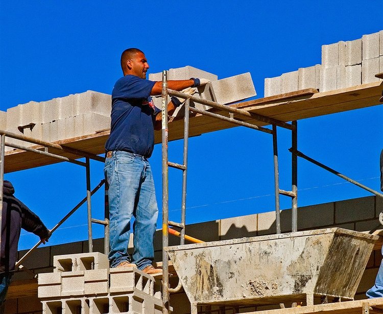
Triax Technologies first made its mark with a sports-impact sensor system and recently expanded into construction with Spot-r, a system that combines a secure wireless mesh network with mobile dashboards and wearable sensors to provide real-time visibility of site safety and productivity. “The wearable not only includes a self-alert button that allows site personnel to report a trip or a fall as it occurs; [it also] allows them to instantly report site hazards that could trigger potential injuries,” Triax President Chad Hollingsworth said. Safety supervisors can also use the sensor to trigger site-wide audible evacuation alerts in the event of an emergency, Hollingsworth added.
The sensors work double duty by allowing site managers to monitor time and attendance among crew members and their location on a particular site. Automatic check-in and check-out obviates the need for head counts and visual checks, allowing managers to focus on a project’s safety and progress.
Data aggregated by Spot-r is collected by a proprietary network and can be viewed by any means capable of accessing the internet, Hollingsworth said.
On the horizon: A new feature will allow site managers to measure the amount of time a worker spends on a bulldozer and whether the operator is certified to use the equipment.
SENSORS: RISK REDUCTION
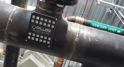
Pillar Technologies focuses on worker safety and quality control. The enterprise deploys on-site sensors to monitor conditions such as temperature, humidity, pressure to noise, dust particulates, and volatile organic compounds, according to Pillar cofounder Sean Iacobone. Based on conditions they detect, sensors can alert site managers to environmental and safety hazards conducive to fires, mold growth, and other issues that that can lead to revenue loss for contractors and insurance companies. For instance, sensors can detect water behind a wall, allowing for remedial measures before moisture spreads elsewhere on-site, Iacobone said.
Information gathered on-site is relayed wirelessly to a cloud, Iacobone said. Warnings and alerts requiring immediate attention are relayed in real time. Data collected from adverse conditions enhance the system’s predictive analytics, which serve to alert managers to conditions that increase the probability of hazards or accidents on-site.
DRONES: SITE AND SYSTEMS EVALUATIONS
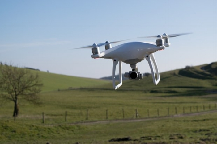
BetterView links businesses with drone-service operators, having facilitated 6,000 roof inspections in the past two years alone. To do so, the enterprise orchestrated a network of more than 4,400 drone operators to capture raw image data and created a software platform to analyze it.
For purposes of construction, the enterprise works with national roofing and paving companies, providing the data required to promote diagnostics, sales, and quality assurance. In the area of commercial real estate, the drones and resulting analytics similarly enhance property management and proactive maintenance.
The value proposition lies in the type and format of the analytics BetterView generates, including interactive orthomosaic maps created by grouping hundreds of overlapping images. The maps allow users to zoom in on areas where more detail, including distances and dimensions, is desired. Digital surface models generated by BetterView provide a quick elevation profile of a property’s terrain. Generation of 3-D models enhances perspective of a building’s vertical dimensions and other property features.
“In the next five years, millions of people will use drones for projects involving gas, real estate, utilities, mining, construction, and clean energy,” predicted BetterView cofounder and CEO David Lyman.
ARTIFICIAL INTELLIGENCE: MANAGEMENT OF PHOTO AND VIDEO DOCUMENTATION
Smartvid.io incorporates machine learning, a form of artificial intelligence, to quickly and easily catalog, retrieve, and analyze imagery captured by drones, wearables, tablets, and other devices on construction sites. A SmartTag engine leveraging machine learning tags visual content on the basis of audio narration, including key words such as “ductwork” or “drywall,” and precise locations to classify imagery collected during video- or photo-based documentation. Alternatively, the software, nicknamed VINNIE, short for Very Intelligent Neural Network for Insight and Evaluation, can recognize and tag certain components on its own, based on a tag-based project dictionary.
All users need do is upload the imagery—up to several videos at time—via Smartvid.io’s app or a mobile web version of the software. On the back end, VINNIE goes to work, matching what is seen or said and classifying information accordingly, dramatically reducing processing time.
Information retrieval is simple. One method involves creating links and locating them in a BIM 3-D model. Once in place, users need only click on the given space to access related visual information.
“We don’t view our mission as simply creating a means to locate imagery, but using speech and automatic recognition to improve safety and productivity,” SmartVid.io founder and CEO Josh Kanner said.
Discussion
Be the first to leave a comment.
You must be a member of the BuiltWorlds community to join the discussion.