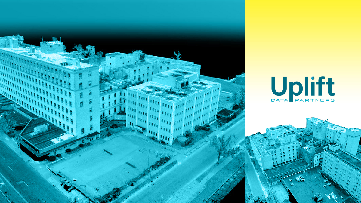
Every day, Uplift Data Partners is tasked with what was impossible even a decade ago: they help capture incredibly precise construction site imagery through the use of sophisticated drone technology. How exactly, though, does a project unfold that needs to be mapped and documented? Earlier this year, the drone company took flight over St. Luke Hospital in St. Louis to help Clayco capture as-built conditions of the abandoned facility.
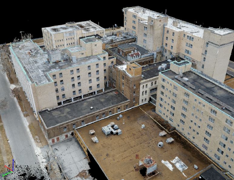
The project at hand aimed to capture enough imagery for photogrammetric processing to generate a point cloud that could then be used by an architect to draw accurate renderings of St. Luke and its architectural features. Traditionally, this would have been handled in-house by Clayco’s laser-scanning technology. The enormous building would take a week to capture using that method, though, and Uplift Data Partners could do the job in just two flight missions.

Providing an experienced pilot from their network, Uplift Data Partners partnered with Drone Deploy to take to the air with a drone equipped with the DJI Phantom 4 PRO camera. The flight plan was a combination of five separate flights, four focusing on the main buildings and one flight of the entire property. “We laid out five aeropoints and painted the locations as well,” explained Uplift Data Partners’ pilot, Damon Lercel, who also holds a Ph.D. in Aviation. “This should expedite things if we fly again.”
The flights discovered that automated flight planning is a crucial first step in the generation of high fidelity point clouds for AEC applications where a high level of accuracy is required. Auto flight planning technology in its current state, Uplift Data Partners found through their flights, cannot be solely relied on to generate the extreme accuracy sometimes necessary in point cloud sets. To solve this issue, Uplift Data Partners combined automated flights with manual flights.
The attention to detail that manual flights provide perfectly complemented the efficiency of automated flights on the St. Louis project. If either automated flights or manual flights are omitted from a mission, Uplift Data Partners found, there will be inconsistent and inadequate overlap in data or a lack of detail. A melding of the two in St. Louis allowed Uplift Data Partners and Drone Deploy to satisfy Clayco’s needs for detailed imagery of the jobsite.
Ultimately, Uplift Data Partners was striving to capture enough imagery that could be used to produce a point cloud within architectural, engineering, and construction tolerances of ¼” to ⅛” point location certainty. Issues arose for the company, many of which were remedied during the second flight, but the end result was satisfactory for the needs of the project, thus saving Clayco significant time and expenditure laser-scanning the building.
These processes are only improving as well, and in time, drone flights will likely not only meet but surpass the quality of capturing imagery of a site the long way around. Pilots in the Uplift Data Partners network are making this reality, combining intricate knowledge of aviation and technology to redefine the way jobsites are scanned.
BuiltWorlds partnered with Uplift Data Partners to bring you this article.
Discussion
Be the first to leave a comment.
You must be a member of the BuiltWorlds community to join the discussion.